


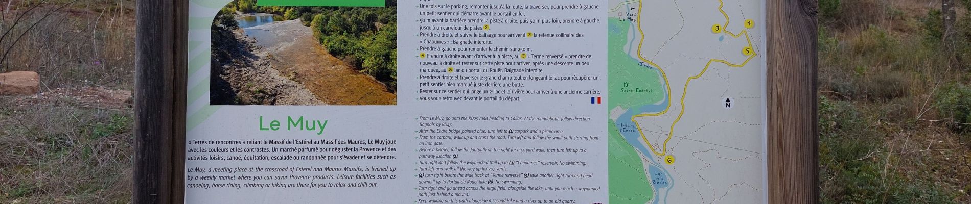
20230225 La colle du Rouet, lac de l'Endre

Sugg
User
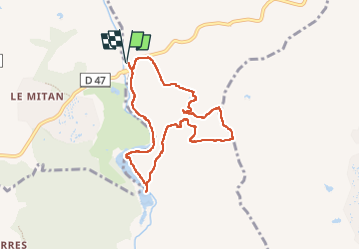

Length
8.2 km

Max alt
74 m

Uphill gradient
88 m
Km-Effort
9.4 km

Min alt
19 m

Downhill gradient
88 m
Boucle
Yes
Creation date :
2023-02-25 12:25:33.076
Updated on :
2023-02-25 22:26:55.498
2h42
Difficulty : Easy

FREE GPS app for hiking
 SityTrail
IGN / Geographical institutes
SityTrail Plus
The world is yours!
About
Trail Walking of 8.2 km to be discovered at Provence-Alpes-Côte d'Azur, Var, La Motte. This trail is proposed by Sugg.
Description
balade digestive cool !!!!!
Photos


Positioning
Country:
France
Region :
Provence-Alpes-Côte d'Azur
Department/Province :
Var
Municipality :
La Motte
Location:
Unknown
Start:(Dec)
Start:(UTM)
305193 ; 4819642 (32T) N.
Comments